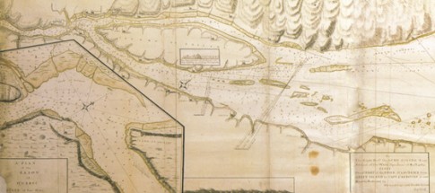
JAMES COOK’S CHART OF THE ST LAWRENCE TO QUÉBEC BY ORDER OF VICE ADMIRAL CHARLES SAUNDERS 1759, fragment above, full chart below
Published by Thomas Jefferys
(Highest resolution available 5640×973)
While the British were enjoying significant success in European waters, the war in Canada had also taken a significant turn. Assaults on French Montréal and Québec were both planned and crucial to the success of both was the navigation of a huge British fleet transporting Major General James Wolfe’s land forces up the St Lawrence River. This was quite a challenge: the navy had no charts of the St Lawrence, which is protected by a number of navigational hazards, and the French in Québec felt quite safe. Aboard the frigate Mercury however was a talented young navigator with an interest in hydrographic surveying named James Cook. In a short time he and a number of other officers had produced a sufficiently accurate and detailed chart of the St Lawrence to allow the entire fleet far enough upriver for Wolfe’s army to be landed to attack Québec. It was the start of a glittering career for the young Cook.

